Nominally, this large group effort involving over 50 scientists and grad students is for "a seismic refraction and wide-angle reflection survey across the Coast Mountains batholith of British Columbia, Canada."
This rather terse description does not really do justice to the project, which has the purpose of discovering why continental mountain ranges are often made of granite instead of basalt. This phase of Batholiths is for performing seismic imaging of the crust and mantle below the Canadian Rocky mountains in British Columbia, one of the largest collection of batholiths (from the Greek bathos, depth + lithos, rock, a large mass of intrusive igneous rock believed to have solidified deep within the earth) in the world. My part of this experiment is as one of six IRIS/PASSCAL scientists assisting with the seismic ranging for the project. This involves deploying thousands of seismic sensors and recorders across British Columbia, and recording responses to several man-made detonations. These responses can then be analyzed to yield, first, seismic velocity profiles; these are then related these to variables such as density or temperature, which in turn are related to chemical composition of the crust and mantle. Many other sources of data are also used, including gravitometric measurements, geochronology, broadband recordings of natural earthquake tremors, and more.
During my discussions with John Hole, one of the project's Principal Investigators (PI's) from Virginia Tech (but a native Canadian, and glad to be working there again), I learned that that basic goal of the project is to locate the "missing pyroxenes." In brief, as the mantle is distilled chemically below the crust, the result is primarily gabbro, a mafic rock quite similar to basalt in chemical composition. Further distillation of gabbro can remove the pyroxene components, leaving what is basically granite which we see in these huge, beautiful batholiths.
 But, where do the pyroxenes go? Are they hiding between the crust and the mantle? Are they melted back into the mantle? Why are mountain ranges not always formed from huge basaltic lava flows? Why is there so much granite in continents?
This project will be ongoing for several weeks in July 2009. Here follow some snapshots to show what it's like to work on a "Big Science" project.
Jump To:
- Days 1,2 (Thursday 9th/Friday 10th)
- Day 3 (Saturday 11th)
- Day 4(Sunday 12th)
- Day 5 (Monday 13th)
- Day 6 (Tuesday 14th)
- Day 7 (Wednesday 15th)
- Day 8 (Thursday 16th)
Days 1,2 (Thursday July 9th, Friday 10th) - Travel/stay in Vancouver, BC
 Vancouver is a beautiful city. We stayed here one day to coordinate with project planners at the University of British Columbia (UBC). Other PI's from Victoria University, Virginia Tech, and several other unitiversities (including UTEP, UQAM, UAlberta, SFU, UM, Williams, Nice, Radford, Ga Tech, Oklahoma, and Cornell) are participating as well.
 Vancouver is the most bicycle-friendly city I've seen. Notice the bike lane between the regular traffic and high-occupancy lanes.
 Vancouver has several public gardens which citizens are encouraged to tend and harvest for their own use.
Day 3 (Saturday, July 11th) - Puntzi Lake Field Center
 Grad students and staffers gearing up for some major equipment unloading. The truck was packed full with equipment for both field centers.
 Grad student Todd Brown (UA) and PASSCAL staffer Michael Johnson unload crates, while PASSCAL's George Slad observes.
 Grad student Amorita Amendariz (UTEP) looks for that next crate.
 The horse stands next to crates of seismic equipment at the Puntzi Lake field center. The experiment is so large that two field centers are being used, separated by ~5 hours travel on steep, winding gravel roads.
 Day 3 (Saturday July 11th) - Travel to Bella Coola Field Center
 Once the equipment and people for the Punzi Lake center were organized, several vans and cars proceeded West to the next Field Center near Bella Coola. Here I am on the way down "the Hill."
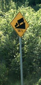
 Did I mention that the "Hill" is a very steep, one-lane, dirt/gravel road with cliffs on one side and nothing on the other?
 This stake indicates one of the surveyed locations for placement of a seismic sensor/recorder. There are thousands of these across the survey area, including some in locations accessible only by boat.
 The hangar at the Hagensborg Airport, near Bella Coola, is the 2nd Field Center. We won't unload the equipment until Sunday the 12th.
Day 4 (Sunday, July 12th) - Bella Coola Field Center
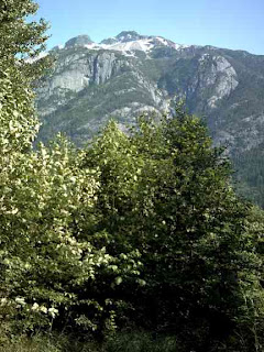
 The airport hangar used as a staging area for the Bella Coola Field Center; Canadian batholiths in the background.
 More work for the Grad Students! Unloading the vans from Puntzi Lake.
 Bob Greschke and Pnina Miller of IRIS/PASSCAL, training the grad students on the proper loading of D-cell batteries into Texans, the beer-can sized recorders used for this experiment. Texans are the nickname for RefTek 125A digitizers; RefTek is based in Amarillo, Texas.
 Shovels and equipment for the field deployers. The Moral: Science often involves a lot of real work.
 Surveyor Kai Wang of Va Tech loads batteries into Texans.
 The array of Crates seems to Grow, and Grow, and Grow...
 Bob Greschke and Pnina Miller of IRIS/PASSCAL, posing in front of a huge Batholith. These mountains are so large that it is virtually impossible to take a head-to-toe photograph of people standing in front of them with an ordinary camera.
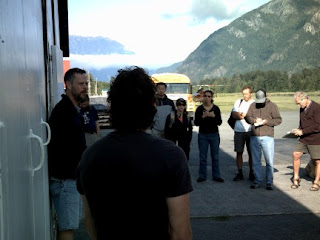
 PIs Ron Clowes (UBC) and John Hole (Va Tech) brief the team on the next day's planned activities.
 Evening - time for a trip to historic Bella Coola Harbour.
Day 5 (Monday, July 13th) - Bella Coola Field Center
 Chris Andronicos (Cornell) briefed the team on the overall purpose of the project. He noted that the huge granite batholiths in this area crystallized from the mantle about only 60 million years ago, with subsequent uplift occurring in the Miocene (~23 to 5 MYa). Being from New Mexico, I am accustomed to the very old (pre-Cambrian) batholiths typified in the Sandia Mountains; see my friend Jim Belshaw's blog for a stupendous picture of the Sandias). Andronicos said that the relative youth of the Coast Mountain batholiths would help immensely in trying to solve the problem of the missing pyroxenes.
 Phil Hammer (UBC) briefs the team on bear safety. Here, he demonstrates typical expressions of people finding themselves being devoured by a bear.
 This is a real forest service bear warning sign. Read it all the way to the end!
 Phil shows the boat deployment crews the fiords of the area.
 Bob Greschke trains team members on proper deployment technique for seismic sensors and recorders.
 Grad student Audrey (UQAM) gets schooled on the "Lunchbox", a portable computer used for programming instruments in the field.
Day 6 (Tuesday, July 14th) - Bella Coola Field Center
 3:00 in the morning on Tuesday, we PASSCAL staffers are hard at work programming the Texans for the boat crews. These beer-can sized digitizers will collect data at certain times over a period of several days.
 5:00 AM, the boat crews arrive at the hangar to pick up their supplies and sensors.
 Down at the docks, John Hole supervises loading of the boats.
 Amorita and Tina haul crates down the dock's loading ramp to the boats.
 Crates of sensors and digitizers wait to be loaded on the boats.
 Phil checks the equipment before embarking.
 Later in the morning, the hiker crews are trained on sensor deployment.
  At the evening briefing, Dr. Hole is joined by PIs Randy Keller (Oklahoma), Ron Clowes (UBC) and Galen Kaip (UTEP). Dr. Hole made the announcement that an environmentalist has deliberately sabotaged some of the blasting equipment, and that the $@%^$ has hit the fan. A pretty one-sided "news" story is available from the Vancouver Sun here.
Day 7 (Wednesday, July 15th) - Bella Coola Field Center
 More crates. It's always all about the Crates.
 Enroute to the hikers' dropoff point. A four-bear morning (plus a fox, who is best friends with a bear. I sense a new cartoon team-up in the forming?).
 A roadblock, courtesy of Mother Nature.
 Randy Keller (OU) supervises the requisite DEET spray-down before the hikers head into the woods.
 A final map+GPS Huddle before the hike begins. The pick-up point is several kilometers away.
 Sending off the hikers: Gaelle, Erin, Shelbie, Grey, Alex, Humberto, Andrew (local guide) and Randy Keller (one of two drivers; I'm the other driver).
 When geologists say they're "working in the Field," sometimes this is what that means.
 Pretty sights on the way to the pickup-up spot.
 This is "Scree." Luckily, this is not what the hikers had to traverse. They returned about 8PM, and we all returned to the lodge.
Day 8 (Thursday, July 16th) - Bella Coola Field Center
 Now that all the instruments and recorders are deployed, everyone except the Shooters get a couple of days off. I spent part of mine biking and hiking in Walker Island Park.
The "Big Cedars" trail in Walker Island Park.
 A bike ride up the road by Nooklikonnic Creek brought me to the quarry; now this is a Batholith, up close and personal!
 Here I am, doing hand specimen petrology on a Batholith. It's very pretty white granite, a mere 60 million years old.
 More Batholithic Closeups at the quarry.
 The work involves weekends, 3 in the morning, whatever it takes. But once the instruments are programmed and deployed, we get a little time off. Here I am blogging away at the Lodge in Hagensborg.
 The area is home to the Nuxalk Nation (pronounced Noo-hawk). Here is a totem pole next to the restaurant block of Bella Coola, B.C.
 Here's a map rendition of the airport facility.
 Our hangar host, Mac, with daughter Ariel. They live right next to the hangar, so we tried not to make too much noise while preparing instruments at 3 AM.
 Bob and Pnina deploy a couple of extra instruments to assess wind effects on sensor cables.
 Here's a geophone about to be deployed. This is a single axis sensor, and measures vertical waves only.
 Pnina gets Ariel's help to deploy the last couple of sensors. Never too early to start training that next generation of seismologists!
Coming up Tomorrow: we hike to the Falls, and find some more Batholiths. Evening: several on the team get close enough to feel one of the late-night detonations.


Great pictures, Dave. I was in BC when I was a kid about 30 years ago and I thought that Vancouver has to be about the coolest city on the planet.
ReplyDeleteI am just curious as to the approximate age of the batholiths. Do they from under the crust and then "emerge?" Or are what we see the eroded remnants of what were craggier peaks?
Good question, Mike. We are getting a briefing this morning (Mon. July 13) from Chris Andronicos of Cornell, who is one of the top honchos on the overall project (not just the seismic imaging, but the whole enchilada). I'll ask him what he thinks, update later.
ReplyDeleteCheers, Dave
great blog! I am sitting in Prague, monitoring the eco-terrist saga. I also reported on the results of ACCRETE to a conference here. Some of you will remember my role in developing Batholiths. I am VERY pleased to see it all coming together. Keep up the good work! The results will likely be really fundamental to understanding earth processes.
ReplyDeleteAnd some advice: don't wear dinner bells. Sing raunchey songs.
Lincoln Hollister
Thanks Lincoln! Check out the Panda's Thumb blog also, as this has some more info on the eco-terrorist and the details of the actual situation.
ReplyDeleteMore stuff tomorrow.
We're shipping off back to Puntzi Lake, ans wireless access is an issue. So, "bear" with me if I don't get the next few days updated in a timely fashion. Work calls!
ReplyDeleteI have gotten copies of Galen's and Phil's photos, so we'll have orcas, bears close up, fly overs and more coming up. Stay tuned!
Dave
Part Two is Published!
ReplyDelete-Dave
Part two can be viewed here.
ReplyDeletesorry. i actually have no idea what a batholith is. my being here is a deception...a net. i spent my entire youth through my 20's in socorro, and though you undoubtably do not remember me, I remember You. i bartended at the Capitol for a few years before Earl died and i once lived with Cow and Stewart back in the day. i was very good friends with (Drunkin') Dunkin Cameron, John Murphin and the household of beer can alley and spent a summer there, having never left after some excuse or another to take LSD and listen to the Dead, back in the summer of '77. but enough reminiscence/name dropping. the real reason that i hope you get around to reading this is "Saucers Over Socorro". A brilliant and insightful glimpse into all things Socorro if ever there was one. i still remember laughing so uproariously over the Tony Jaramillo One Way Plaza Confusion that people glanced nervously away from what was obviously a man in the latter stages of syphyllis and could be contagious. but...to the point. where can i aquire copys of the entire run? as i am sure you know, The Socorro Chiefton (Where the strip appeared) has gone the sad way of most printed media...it has run out of ink. so to speak. even if you cannot advise me in this regard, it would be nice to chat about 1970's Socorro. Take care and remain skeptical, Barry Lewis June 6, 2015.
ReplyDeleteGood share
ReplyDelete